Beyond Skyrim:Cyrodiil/County Bruma
This article is about the county. For the city, see Bruma.
|
||
|---|---|---|
| Capital | Bruma | |
| Count's Residence | Castle Bruma | |
| Military Fort | Fort Pale Pass | |
| Government | ||
| Count | Desilus Carvain | |
| Steward | Rignar | |
| Location | ||
| Northern Cyrodiil | ||

County Bruma is a county in northern Cyrodiil, with its capital in Bruma. It is ruled by Count Desilus Carvain from his seat in Castle Bruma and has been left relatively untouched by the civil war raging north of the Jeralls, although it does face challenges from renegade Stormcloaks and a bloodthirsty criminal gang.

Topographical Overview[edit]
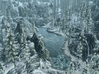
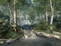
County Bruma encompasses the southern side of the Jerall Mountains and the northeastern section of the Great Forest. It borders Skyrim to the north, County Cheydinhal to the east, County Chorrol to the west, and the Imperial Heartlands to the south. The county can be divided based on latitude into two roughly equally-sized regions, the city of Bruma marking the nominal boundary. In the north is a harsh area characterized by craggy peaks, snow drifts and icy pine forests, while in the south is a more fertile area of flowing rivers, green hills and deciduous forests. Meanwhile, the Silver River begins its course from the frigid lake of Reman's Mirror before flowing southwards and bisecting the county into eastern and western halves.
The walled city of Bruma lies roughly in the center of the county, while the villages of Applewatch and Greenwood lie to the northeast and south respectively. Overlooking Bruma to the west is the large massif of Gnoll Mountain, with the fabled Frostcrag Spire crowning its peak. North of Bruma also lie the ruins of Cloud Ruler Temple, the once-mighty home of the Blades.
Flora and Fauna[edit]
County Bruma is home to many wild creatures, such as timber wolves, mountain lions and masked bears, and dangerous monsters including minotaurs, ogres and river trolls. The flora of the county is similar to that on the other side of the Jerall Mountains, in Skyrim, although it does present some variation based on latitude and boasts some unique plants including clouded funnel mushrooms, milk thistle, motherwort, red and yellow cinnabar polypore mushrooms and wormwood.
Routes and Pathways[edit]
The Silver Road links Skyrim to the rest of Cyrodiil, entering the county just south of Greenwood and leaving it through the Skyrim Border Gate and the Pale Pass. The Orange Road stretches east to west, linking Chorrol to the Silver Road, while numerous unmarked dirt roads help connect the county's various locations.
Places[edit]
All locations in County Bruma with individual map markers are listed. There are a few places without map markers listed for their significance.
County Capital[edit]
 Bruma — A major city located in the center of County Bruma.
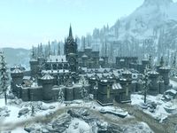
 Castle Bruma — A large fortress which serves as the residence of the count of County Bruma, the county's seat of political power, and the location of the county's jail. (map)
 Bruma Stables — A stable located outside Bruma, north of the eastern gate. (map)
Farms, Towns, and Settlements including Orc Strongholds and Inns[edit]
- Aleswell*
 Applewatch — A small farming town in the Jerall Mountains, west of Bruma. (map)
 Gautierre Manor — A private estate in the northern reaches of County Bruma. (map)
 Greenwood — A meadery in the southern reaches of County Bruma. (map)
 Hunter's Shack — An isolated dwelling inhabited by hunters, located on Gnoll Mountain south of Frostcrag Spire and northwest of Fort Horunn. (map)
 Lakeside Retreat — A lakeside cottage overrun by bandits, located northeast of The Beast's Maw and southwest of Rock Creek Camp. (map)
- Maulochdur*
 Riverside Shack — An unmarked fishing lodge overrun by mudcrabs, located southeast of Bruma Eastern Watchtower and west of Shrine of Namira. (map)
 Sercen Hills Forester Outpost — An unmarked forester outpost, located southeast of Whitewood Creek and southwest of The Beast's Maw. (map)
 Snowstone Rest — An inn in the far north of County Bruma. (map)
Ayleid Ruins[edit]
 Anga — A small Ayleid ruin containing Namira cultists, located east of Greenwood. (map)
- Lindai*
- Moranda*
- Ninendava*
- Piukanda*
 Rielle — A medium-sized Ayleid ruin containing undead Ayleids, located northeast of Applewatch and southwest of Cloud Ruler Temple. (map)
 Sedor — A large Ayleid ruin containing bandits and undead Ayleids, located northeast of Silver Tooth Cave. (map)
Camps[edit]
 Camp of the Devout — A camp of Talos worshipers in the far east of County Bruma, south of Gutted Mine. (map)
 Plump Rat Camp — A bandit camp located just southwest of Reman's Fist and south of Underpall Cave. (map)
 Rock Creek Camp — A bandit camp located south of Silver Tooth Cave and northeast of Lakeside Retreat. (map)
Caves[edit]
 The Beast's Maw — A medium-sized cave containing animals and trolls, located southeast of Frostfire Glade and southwest of Lakeside Retreat. (map)
 Boreal Stone Cave — A small cave containing an ogre, located northwest of Applewatch. (map)
 Bruma Caverns — A large cave containing animals, bandits, and frost trolls, located east of Bruma. (map)
 Capstone Cave — A small cave containing bandits, located northeast of Applewatch. (map)
 Cutpurse Hideout — A large cave occupied by Thorina's Cutters, located south of the Bruma. (map)
- Echo Cave*
- Fingerbowl Cave*
 Freezewind Hollow — A small cave containing frostbite spiders, located west of Frostcrag Spire. (map)
 Frostfire Glade — A cave containing animals, monsters, atronachs and ice wraiths, located northeast of Whitewood Creek and southeast of Red Ruby Cave. (map)
 Frozen Grotto — A small cave located northeast of Gutted Mine. (map)
- Glademist Cave*
 Hjalti's Refuge — A small cave containing dead Talos worshipers, located southeast of Frostcrag Spire. (map)
- Moss Rock Cavern*
 Northfringe Cave — A medium-sized cave containing animals and draugr, located east of Snowstone Rest. (map)
- Outlaw Endre's Cave*
 Red Ruby Cave — A medium-sized cave containing vampires and animals, located northeast of Frostfire Glade. (map)
 Serpent's Trail — A large cave containing smugglers and goblins, located northwest of the Pale Pass and south of Snowstone Rest. (map)
 Silver Tooth Cave — A medium-sized cave containing goblins, located southwest of Sedor and north of Rock Creek Camp. (map)
 Toadstool Hollow — A small cave containing animals and bandits, located north of Greenwood. (map)
 Underpall Cave — A large cave containing Revenant necromancers, located southwest of Bruma and north of Plump Rat Camp. (map)
 Unmarked Cave — A small cave containing animals, located west of Greenwood and southeast of Reman's Fist. (map)
Mines[edit]
- Exhausted Mine*
 Gutted Mine — A medium-sized silver mine containing vampires, located north of the Camp of the Devout and southwest of Frozen Grotto. (map)
 Plundered Mine — A small mine containing bandits, located south of Gautierre Manor and east of Bruma Eastern Watchtower. (map)
- Stoneridge Mine*
Towers and Forts[edit]
 Bruma Eastern Watchtower — A guard tower protecting the eastern approaches to Bruma. (map)
 Bruma Western Watchtower — A guard tower protecting the western approaches to Bruma. (map)
- Fort Caractacus*
- Fort Coldcorn*
 Fort Horunn — A large fort containing conjurers and daedra, located northeast of Frostfire Glade and southeast of the Hunter's Shack. (map)
 Fort Pale Pass — A large fort occupied by Imperial soldiers, located south of the Skyrim Border Gate. (map)
Daedric Shrines[edit]
- Shrine of Mephala*
 Shrine of Namira — The shrine to the Daedric Prince Namira, located southeast of Plundered Mine and northwest of Red Ruby Cave. (map)
Landmarks, including Bodies of Water, Clearings and Passes[edit]
 Cloud Ruler Temple — A large mountain-top fort inhabited by ghostly Blades, located north of Bruma. (map)
 Dragonclaw Rock — A distinctively shaped rock in the Jerall Mountains, southeast of The Sentinel. (map)
 Frostcrag Spire — A magical tower located east of Bruma, atop Gnoll Mountain. (map)
- Gnoll Mountain — A large mountain in the Jerall Mountains east of Bruma. (map)
 Reman's Fist — A rocky outcrop in the southern reaches of County Bruma, located northeast of Plump Rat Camp and northwest of Unmarked Cave. (map)
- Reman's Mirror — A lake in central County Bruma. (map)
 Skyrim Border Gate — A pass through the mountains in the far north of County Bruma. (map)
 The Sentinel — A stone monument in the Jerall Mountains, southeast of the Serpent's Trail. (map)
 Whitewood Creek — A small river pond inhabited by spriggans, located east of Anga and west of The Beast's Maw. (map)
Unmarked Places[edit]
- There is one Ayleid well in Country Bruma:
- Northwest of Unmarked Cave
- There are three Shrines in Country Bruma:
- A Wayshrine of Akatosh east of Cutpurse Hideout
- Two Shrines of Talos:
- Southwest of Cutpurse Hideout
- Southeast of Gautierre Manor
*Not in the Bruma pre-release area
County Bruma Quests[edit]
Bruma Guard[edit]
- Absent Antiquity: Find some stolen Akaviri artifacts.
- A Delicate Situation: Help the Captain of the Guard deal with some Talos worshippers.
- Against the Cutters: Eliminate the toughest criminal gang in County Bruma.
- Service Rewarded: Receive your reward for all you have done for Bruma.
Side Quests[edit]
- A Stormcloak in Chains: Help or hinder a captured Stormcloak.
- Alammu's Veil: Reunite a poor Dark Elf with her... family heirloom.
- The Courier: Help a son of Skyrim rescue his friend and his important documents.
- The Screeching Songman: Rid the good people of Bruma of a talentless singer's screechings.
- The Way Home: Put the spirits of the Blades to rest at Cloud Ruler Temple
- Ugly Love: Track down an Orc mercenary's missing wife.
- Undeath at Underpall: Clear the necromancers from Underpall Cave.
- Upon My Honor: Find out what happened to a missing Imperial soldier
- Welcome to Cyrodiil: Find a way to enter Cyrodiil
- Whispers of the Mountain: Investigate the appearance of mysterious objects at the Bruma Synod Conclave
Other[edit]
In addition, many miscellaneous quests are located in County Bruma. They are listed here.
