User:Daric Gaersmith/Cartography/Digitizing
Line Width Problem[edit]
One problem that I have experienced while digitizing a map of Tamriel using QGIS, is with the width of the coastlines on the source raster image. As the official maps are highly stylized, and not intended to be accurate topographical maps, the coastlines are drawn as being of varying widths (Image 1). When digitizing these lines, I have to somehow decide whether to take the coastline as being inside, outside, or through the middle of the black pixels that represent the coastline.
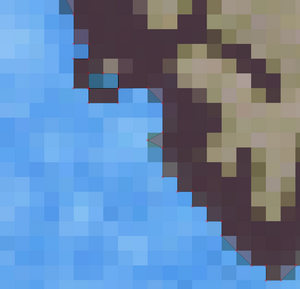
As you can see from the second example image on the left of this page (Image 2), a vector map can be much more exacting than a bitmap / raster image. If you understand fractal dimensioning, you'll know that I should be able to zoom my vector map of Tamriel in so close that I could fit hundreds, or even thousands of vector points into a single pixel of the source raster image. This is why I have been searching for the highest resolution raster image that I can find. As I zoom in, my vector map becomes just as jagged as the source raster map. The third example, below, demonstrates this issue quite well. There are some places in this example image where I have bisected a single pixel into two triangles, and in one place I even turn a single square pixel into three triangles. This example uses the outside edge of the black coastline pixels, rather than the centerline.

I can just image myself going on a tour of Tamriel, using the games we have available to us, and walking my character around the landscape, tidying up the vector lines on my map as I go, to a very high level of magnification / zoom. Such a journey would be epic, and would take a huge amount of time. I have seen somewhere that there is a mod for Morroblivion that adds a GPS spell. When it is invoked, it displays the player character's current x,y coordinates. That would be handy in such a map-making journey across Tamriel!

