Skyrim Mod:Saints and Seducers/Maps
The UESPWiki – Your source for The Elder Scrolls since 1995

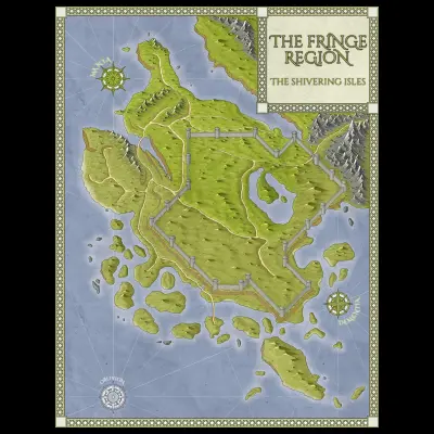
Map of the Fringe Region by Caites
This page provides information on various maps concerning Skyrim: Extended Cut - Saints and Seducers.
General Maps[edit]
- Skyrim: Extended Cut - Saints and Seducers Paper Map for FWMF — A map of the Fringe Region designed by Caites for use with the Flat World Map Framework.
Icons[edit]
These are the icons used on the in-game map of the Shivering Isles.
On the compass and map, white locations are places you have previously visited (and therefore may fast travel to), and those in black are undiscovered. Only the icons of places you've been to or you've heard about will show up on your map.
Shivering Isles |
||||||||||||||||
|
||||||||||||||||