Shivering talk:Maps
Contents
Map[edit]
Can we possibly get a map with all of the locations on it? I'm thinking this won't nearly be as hard as the original game. --UltimateCrouton 03:27, 29 March 2007 (EDT)
New Shivering Isles map[edit]
I only just finished making this map, so there may need some fixing if any errors are found. So let me know if theres any errors, spelling mistakes or whatever. BTW, I removed the old icon map that was there, it was kinda pointless now that we have a labelled map. Vality7 12:41, 3 April 2007 (EDT)
- One thing you should change is the Licensing. Unless you drew it by hand, you're using copyrighted material from Bethesda, which falls under Fair Use, but it's not Public Domain as you've chosen. {{esimage}} would be the proper license for any Bethesda-sourced images. --TheRealLurlock Talk 15:04, 3 April 2007 (EDT)
Ok i've changed it. Am I allowed to upload my full sized image or is the limit 1024? Vality7 22:19, 3 April 2007 (EDT)
- You can upload the full size image if you'd like. Just upload it using the same file name and it will overwrite the 1024 resolution one. You'll probably get a warning about the image being larger than recommended, but it's OK to have high resolution maps that are larger than usual. The version of the map that will get shown on wiki pages will always be a thumbnail of the full size map (i.e., on this page it's showing a 700px resolution thumbnail), that way it won't hog the bandwidth every time someone views the page. But anyone who wants to see the high resolution version can access it from the image page. --Nephele 22:52, 3 April 2007 (EDT)
-
- Frelling amazing map - fantastic work BTW Pferris 23:38, 3 April 2007 (EDT)
Shoop-da-Woop[edit]
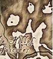
That's fantastic, but I have something to report about the map overall, not just this specific one. As you will see in this image, this referenced section of the Shivering Isles map looks suspiciously like a shoop-da-woop. I wonder now if this was placed here on purpose. But on a different note, this is my first edit in a while and I'm glad to be back on the site. Here is the image:
— Unsigned comment by M'aiq the Liar (talk • contribs) on 6 December 2008
- I have to say I'm usually sceptical of easter eggs... but that one looks possible. Although given that people can see the face of Jesus in a pizza, it could easily be the brain's pattern-recognition software glitching again. –Rpeh•T•C•E• 06:58, 12 December 2008 (EST)
I really don't see it... where is the face supposed to be?--Playerjjjj 00:35, 5 July 2012 (UTC)Playerjjjj
Security concerns[edit]
The links "Cyrodiil & Shivering Isles Online Map" and "Interactive map of Shivering Isles," have both been blocked by my security programs as "Attack Sites." Does anyone know why this would happen? Jimmy D Staggs 17:22, 4 December 2009 (UTC)
- They must be false positives, it's a problem with your security programs. There is nothing wrong with both sites. --Timenn-<talk> 18:09, 8 December 2009 (UTC)
Valenwood[edit]
I took out my copy of the Cyrodiil & SI-map included in the GotY edition and I noticed a very odd landmark on it... The map looks identical to the ones on this page (apart from it also showing Cyrodiil) with one difference; the word "Valenwood" written north of Overlook Road and east of Isle of Flame. Now since Valenwood is a different province and not related to SI in any way, this surely must be a mistake...? MrL 20:48, 3 December 2011 (UTC)
- I noticed this as well, but there's a simple explanation. Look around the borders of Cyrodiil; each province is marked. In clockwise order: Hammerfell, Skyrim, Morrowind, Black Marsh, Elsweyr, and *drumroll please* Valenwood. It seems to be a mistake on the part of the printers; they didn't move Valenwood's label before adding the Shivering Isles map, making it appear that Valenwood is the Northern portion of the Shivering Isles. Valenwood is not so, and is indeed a southwestern province of Tamriel. Chunk of Ham 23:07, 4 December 2011 (UTC)
Imean Sea[edit]
The western perimeter of the Imean Sea is very shallow. If this is intended, should it be indicated on the map? If one continues wading westward off the plane there is a drop to "ground." However in returning the plane of Sheogorath there is no climb.--Lmstearn (talk) 13:04, 19 July 2014 (GMT)
