Online:Antique Maps
The UESPWiki – Your source for The Elder Scrolls since 1995
Contents
- 1 Antique Map of Alik'r Desert
- 2 Antique Map of Apocrypha
- 3 Antique Map of Auridon
- 4 Antique Map of Bangkorai
- 5 Antique Map of Blackwood
- 6 Antique Map of Coldharbour
- 7 Antique Map of Craglorn
- 8 Antique Map of the Deadlands
- 9 Antique Map of Deshaan
- 10 Antique Map of Eastmarch
- 11 Antique Map of Fargrave
- 12 Antique Map of Galen
- 13 Antique Map of Glenumbra
- 14 Antique Map of the Gold Coast
- 15 Antique Map of Grahtwood
- 16 Antique Map of Greenshade
- 17 Antique Map of Hew's Bane
- 18 Antique Map of Malabal Tor
- 19 Antique Map of Murkmire
- 20 Antique Map of Northern Elsweyr
- 21 Antique Map of The Reach
- 22 Antique Map of Reaper's March
- 23 Antique Map of The Rift
- 24 Antique Map of Rivenspire
- 25 Antique Map of Shadowfen
- 26 Antique Map of Southern Elsweyr
- 27 Antique Map of Stonefalls
- 28 Antique Map of Stormhaven
- 29 Antique Map of Summerset
- 30 Antique Map of the Telvanni Peninsula
- 31 Antique Map of Vvardenfell
- 32 Antique Map of Wrothgar
Antique Maps are special pieces of furniture that can be excavated via the Antiquities system.
The leads can be bought for 1,000 gold each from general goods merchants (including innkeepers) in the respective zones, if the Pathfinder achievement for the zone was unlocked.
When excavated, each furnishing includes codex entries from members of the Antiquarian Circle: Amalien, Gabrielle Benele, Reginus Buca, Ugron gro-Thumog and Verita Numida.
Purchasing a lead and excavating the map will unlock the first codex entry only, thus the lead of any given map needs to be purchased three times to unlock all its entries. Expanding this to all available maps, over 80,000 gold must be spent in order to collect every antique map codex entry.
Antique Map of Alik'r Desert[edit]
| Antique Map of Alik'r Desert (view item page) |
||
|---|---|---|
| This map maker's aesthetic depicts the vast desert of Alik'r in gentle flowing lines, representing dunes that have long since shifted. | 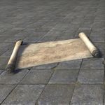 |
|
| Lead Location | The Lead can be bought from general goods merchants throughout the Alik'r Desert for 1,000 gold. Alik'r Desert Pathfinder achievement required. | |
| Codex Entries | An Alik'r nomad tribe's map with a sparse frame of reference and no borders to speak of. Sentinel appears to be the only significant settlement of note. Instead, there is a focus on landmarks and hazards. A giant serpent's body is woven throughout. —Verita Numida | |
| Not unlike the sea serpents scrawled in naval charts, eh? This must be Satakal, the Yokudan serpent god. They believed we all dwell upon the serpent, so it's safe to assume that this is a symbolic representation. —Reginus Buca | ||
| I've spoken at length with nomad tribal chieftains. Most claim that the dunerippers we see now are a fraction of the size of those the first Ra Gada encountered. Could be a correlation, but any evidence has long been weathered away by shifting sands. —Ugron gro-Thumog | ||
Antique Map of Apocrypha[edit]
| Antique Map of Apocrypha (view item page) |
||
|---|---|---|
| Mapping Apocrypha and expecting the result to help anyone else is foolish. Instead consider the map to be more of a visual guide to the cartographer's experiences there—unique to them alone."—Excerpt from an unknown Cipher's Journal |  |
|
| Lead Location | The Lead can be bought from general goods merchants throughout the Telvanni Peninsula or Apocrypha for 1,000 gold. Hero of Necrom achievement required. | |
| Codex Entries | Intriguing. This map purports to be of Apocrypha, but while the major locations, like Cipher's Midden, are there, they're in different locations. Perhaps this was done by someone with second-hand information? —Gabrielle Benele | |
| Possible. More likely Hermaeus Mora chose to do a little redecorating. He has the power to do that, you know. Still, the major landmarks are all here, but I would not use it to give someone directions. —Reginus Buca | ||
| The lands of Oblivion represent the minds of the Daedric Princes, and warp and change as they themselves change and grow. In a century's time, our maps of Apocrypha will be as out of date and this one seems to be. —Amalien | ||
Antique Map of Auridon[edit]
| Antique Map of Auridon (view item page) |
||
|---|---|---|
| One of the Summerset Isles, Auridon is painstakingly rendered on this map to the exacting standard of the College of Sapiarchs. | 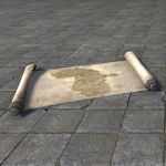 |
|
| Lead Location | The Lead can be bought from general goods merchants throughout Auridon for 1,000 gold. Auridon Pathfinder achievement required. | |
| Codex Entries | Oh! Clearly this is one of the Summerset Isles! Auridon, in fact. Nine Prows Landing is marked on it, too, which makes me think it's an early map. —Amalien | |
| Or perhaps someone chose to note that location on this map since it is culturally significant, Amalien. Haven't I seen you do that yourself when you're sketching out your own maps? —Reginus Buca | ||
| Hmmm ... you're right. I definitely do that. And I see that there's a note about potential locations for the Mages Guild, which puts this at around 2E 230, so much later than I had hoped! —Amalien | ||
Antique Map of Bangkorai[edit]
| Antique Map of Bangkorai (view item page) |
||
|---|---|---|
| The entire region of Bangkorai is shown on this antique map, though much of the detail is focused on the daunting Bangkorai pass. | 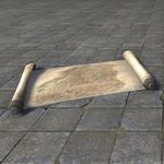 |
|
| Lead Location | The Lead can be bought from general goods merchants throughout Bangkorai for 1,000 gold. Bangkorai Pathfinder achievement required. | |
| Codex Entries | I'd date this around the early to mid First Era. The kingdom of Ojwambu occupies the southern half of Bangkorai. It was sacked by the warlord Mahgzoor Rockhand, likely in retribution for driving the Goblins from their lands in Hammerfell. —Reginus Buca | |
| Attacks like these were used to justify the sacking of Orsinium, despite the fact that Goblins did not occupy the city. According to oral histories, the Orc clans and Goblin tribes maintained a truce within the Dragontail Mountains, but did not mingle. —Ugron gro-Thumog | ||
| If it was prior to the Siege of Orsinium, it was probably after the exodus of Orcs and Goblins in 1E 874. That narrows the fall of Ojwambu and establishment of Hallin's Stand to the seventy-four years between! We're close! —Reginus Buca | ||
Antique Map of Blackwood[edit]
| Antique Map of Blackwood (view item page) |
||
|---|---|---|
| On this heirloom map, the areas populated by Nibenese contain a wealth of details about the terrain, while expanses of wilderness seemingly remain fully unexplored. | 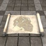 |
|
| Lead Location | The Lead can be bought from Innkeepers and General goods merchants in Blackwood for 1,000 gold. Blackwood Pathfinder achievement required. | |
| Codex Entries | his is a map of the Blackwood region. The parchment is worn, but it is still detailed, especially along the coast. There is something strange here, though I can't put my finger on it. Still, the map shows caves even I've forgotten about! —Gabrielle Benele | |
| What strikes me about this map is that the lines appear to have been drawn in squid ink. See how it faded to brown, like the parchment, rather than gray or black? The use of squid ink suggests a sailing vessel rather than a cartographer's shop. —Reginus Buca | ||
| Regius is right about this map, the focus on waterways shows a sailor's eye. See how the Snake Tail River opens into marshlands instead of carrying on to the Niben itself? That might date the map between the flood off 2E 218 and the Crow's Storm of 2E 255. —Ugron gro-Thumog | ||
Antique Map of Coldharbour[edit]
| Antique Map of Coldharbour (view item page) |
||
|---|---|---|
| One might question the sanity of the cartographer of this map, but according to experts in planar travel, it's remarkably accurate. | 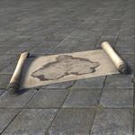 |
|
| Lead Location | The Lead can be bought from general goods merchants throughout Coldharbour for 1,000 gold. Coldharbour Pathfinder achievement required. | |
| Codex Entries | I think we're all in agreement that this is a map of Coldharbour, yes? Take it from someone who knows: Coldharbour is hard to forget. —Gabrielle Benele | |
| Coldharbour is supposed to emulate Nirn itself, but it always surprises me how innocuous it looks when depicted in a map. Those brave enough to document it did so with little bias, it seems. —Reginus Buca | ||
| I can't imagine this map will stay accurate for long. Correct me if I'm wrong, Gabrielle, but I believe Daedric realms change as often as their ruling Prince's mood. Who knows what Coldharbour will look like in centuries to come. —Amalien | ||
Antique Map of Craglorn[edit]
| Antique Map of Craglorn (view item page) |
||
|---|---|---|
| The cartographer who worked on this antique map detailed the dry wastelands of Lower Craglorn and mountainous regions of Upper Craglorn with a deft hand. | 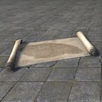 |
|
| Lead Location | The Lead can be bought from general goods merchants throughout Craglorn for 1,000 gold. Lower Craglorn Pathfinder and Upper Craglorn Pathfinder achievements required. | |
| Codex Entries | Given the relative position of the land to the Dragontail Mountains, this has to be a map of Craglorn. Marvelous! —Reginus Buca | |
| Few places in Tamriel have changed hands more than Craglorn. Just by the sheer amount of different ruins that can be found there, it's hard to tell what perspective this was drawn from. —Gabrielle Benele | ||
| Yes. Nedes, Orcs, Yokudans, Ayleids, Dwarves ... the list goes on and on! It's almost comforting to know that despite its tumultuous history, the land itself remains largely unchanged. —Verita Numida | ||
Antique Map of the Deadlands[edit]
| Antique Map of the Deadlands (view item page) |
||
|---|---|---|
| Long ago, several explorers of the Burn and the Sever worked together to map out these areas of the Deadlands, though regrettably not all who started this cartography project lived to see its result. | 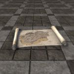 |
|
| Lead Location | The Lead can be bought from Traveling Merchants in The Deadlands for 1,000 gold. Deadlands Pathfinder achievement required. | |
| Codex Entries | This appears to be a map of Mehrunes Dagon's realm. Cosmic matters like the width and breadth of a Daedric realm are outside my area of expertise, but I have no reason to doubt its authenticity. The vellum it's made from is unsettling to say the least.—Reginus Buca | |
| This is the work of a Dremora. You see the ragged edges? The parchment was roughly flensed. From what, I'd rather not speculate. Odd that they'd choose this one region to chart. Gabrielle seems to think the Deadlands are broad beyond comprehension. —Verita Numida | ||
| Gabrielle is right! I know a reputable Daedrologist who says the Deadlands are spotted with seven hundred and seventy-seven different fortifications. There's only a handful here, so these must be really important! —Amalien | ||
Antique Map of Deshaan[edit]
| Antique Map of Deshaan (view item page) |
||
|---|---|---|
| The fertile plain of Deshaan stretches out on this artful map. | 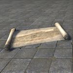 |
|
| Lead Location | The Lead can be bought from general goods merchants throughout Deshaan for 1,000 gold. Deshaan Pathfinder achievement required. | |
| Codex Entries | From the dark shading in the northern region of this map, it seems likely this maps dates to soon after the first eruption of Red Mountain. Sometime very soon after 1E 668. Deshaan experienced significant climate disruption during this period. —Reginus Buca | |
| Ah yes. The Sun's Death! I see several roads leading away from the darkened areas. Perhaps these were Dunmer escape routes, showing the way to new settlements?—Amalien | ||
| The idea that a cartographer managed to create a map in these conditions defies credulity. Red Mountain's eruption, the end of the First Council's war, the curse of Azura .... An artist probably rendered this as a historical map a hundred years later. —Ugron gro-Thumog | ||
Antique Map of Eastmarch[edit]
| Antique Map of Eastmarch (view item page) |
||
|---|---|---|
| A master cartographer lent their skills to the crafting of this map of Eastmarch untold years ago. | 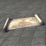 |
|
| Lead Location | The Lead can be bought from general goods merchants throughout Eastmarch for 1,000 gold. Eastmarch Pathfinder achievement required. | |
| Codex Entries | Skyrim, the Old Holds. Eastmarch, specifically--the former heartland of the Nord Empire. —Ugron gro-Thumog | |
| Windhelm in particular is the oldest human settlement in all of Tamriel. One wonders what stories and treasures have been forgotten in this ancient land.—Verita Numida | ||
| I'm reminded of one: There's an old Nordic legend about how the hero Wuundig fought a mighty Daedra here and melted it with a flaming hammer. The hot springs of Eastmarch are what's left of the monster. —Reginus Buca | ||
Antique Map of Fargrave[edit]
| 50px | Antique Map of Fargrave (view item page) |
|
|---|---|---|
| Though Fargrave defies most labels, an ambitious cartographer still attempted to map it out. Discerning collectors may wish to hang the result in a place of pride. The original owner no longer needs it. | 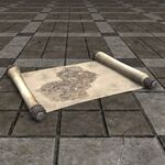 |
|
| Lead Location | The Lead can be bought from (?) in Fargrave for 1,000 gold. Deadlands Pathfinder achievement required. | |
| Codex Entries | Judging by the depictions of the enormous skeletons, this must be a map of Fargrave. It's a little disjointed. The Plaza of Portals are depicted, but the rest of the points on the map seem to defy my very gaze. It's disorienting, to say the least. —Reginus Buca | |
| It's disorienting, but given the ink and the paper I would surmise that this was penned by a mortal hand. Given what happens to mortals when they spend too long in Oblivion, I suspect the phenomenon known as "the Drain" might play a factor here. —Verita Numida | ||
| Verita is right! There are a great deal of landmarks here that I don't recognize from modern portrayals of Fargrave. Could they be ancient, forgotten fortifications of the Celestial Palanquin? Or just the wanderings of a withering mortal mind? —Amalien | ||
Antique Map of Galen[edit]
| Antique Map of Galen (view item page) |
||
|---|---|---|
| The artistic touches on this well-preserved map of Galen resemble those of other Breton maps of this period. Its illustrative elements flow organically, casting doubt on the cartographer being a single Breton. | 150px | |
| Lead Location | The Lead can be bought from Archimbert Vygrant or Hyaidouna in Vastyr for 1,000 gold. Galen Pathfinder achievement required. | |
| Codex Entries | . —Ugron gro-Thumog | |
| .—Verita Numida | ||
| . —Reginus Buca | ||
Antique Map of Glenumbra[edit]
| Antique Map of Glenumbra (view item page) |
||
|---|---|---|
| This detailed map highlights the complex topography of Glenumbra thanks to the artistry of the cartographer who crafted it. | 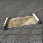 |
|
| Lead Location | The Lead can be bought from general goods merchants throughout Glenumbra for 1,000 gold. Glenumbra Pathfinder achievement required. | |
| Codex Entries | Map of the Direnni Hegemony, circa 1E 484. I note some discrepancies in the topography. There are some, shall we say, natural borders that don't align with the current lay of the land, or maps drawn a mere twenty years after. —Reginus Buca | |
| I concur. These irregularities are taking great liberties with the region. This map from the same year omits Camlorn entirely. This hardly seems like a mere oversight. I believe this was a deliberate attempt to obfuscate their shrinking territories.—Verita Numida | ||
| The Direnni had some of the most powerful mages in the world at the height of their reign. Maybe they weren't just changing the maps? What if their Camlorn really did disappear? Like the Dwemer? Or Artaeum? Maybe we'll find it! Wouldn't that be something? —Amalien | ||
Antique Map of the Gold Coast[edit]
| Antique Map of the Gold Coast (view item page) |
||
|---|---|---|
| Though this antique map doesn't note it, the Gold Coast was once called the Strident Coast. | 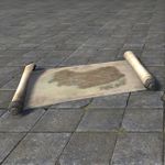 |
|
| Lead Location | The Lead can be bought from general goods merchants throughout Gold Coast for 1,000 gold. Gold Coast Pathfinder achievement required. | |
| Codex Entries | I think it's fairly obvious that this is a depiction of the Gold Coast. A beautifully rendered one at that. —Reginus Buca | |
| It's interesting to think about maps drawn before and after the construction of Varen's Wall. Each tell quite a different story about the land and it's people! —Amalien | ||
| I'd be curious to see a map of this area from the First Era, if such a thing could ever be found. All that remains of the great Ayleid settlements is broken marble and subterranean dangers. A fitting end for such a terrible people. —Verita Numida | ||
Antique Map of Grahtwood[edit]
| Antique Map of Grahtwood (view item page) |
||
|---|---|---|
| Careful attention was paid to marking the well-trod footpaths through the old growth of Grahtwood. | 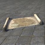 |
|
| Lead Location | The Lead can be bought from general goods merchants throughout Grahtwood for 1,000 gold. Grahtwood Pathfinder achievement required. | |
| Codex Entries | Hmm, this is difficult to read, but I believe it's a map of the southeast Valenwood. This region is known as the Grahtwood, after the graht-oaks that are found in great numbers there. —Verita Numida | |
| Curious--Falinesti is marked on the map. I know that the city hasn't been seen in many years, but even in the days when it was accessible, I thought that the Walking City's location was uncertain. —Reginus Buca | ||
| Uncertain? No, although I can understand why you might think so. Falinesti moved with the seasons, traveling to different parts of the Valenwood. From year to year, it took root in the same spot during each season--this map marks its winter site. —Amalien | ||
Antique Map of Greenshade[edit]
| Antique Map of Greenshade (view item page) |
||
|---|---|---|
| Nearly a work of art in itself, this map of Greenshade provides some insight into what the region might have looked like in an earlier time. | 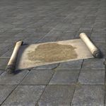 |
|
| Lead Location | The Lead can be bought from general goods merchants throughout Greenshade for 1,000 gold. Greenshade Pathfinder achievement required. | |
| Codex Entries | This looks like southwestern Valenwood to me. Yes, this must be Greenshade. —Gabrielle Benele | |
| Yes, this seems quite old. Modern maps of the region evince High Elf influence. Remember, the Dominion has tried to influence Greenshade both culturally and architecturally. This map seems to predate their concerted attempts to do so. —Reginus Buca | ||
| Yes, the Bosmer only barely tolerate my people. Hard to blame them. Travelers don't know the true layout of the area because they stick to the cities for trade and travel. This is detailed enough that it might be from the Wood Elves themselves! —Amalien | ||
Antique Map of Hew's Bane[edit]
| Antique Map of Hew's Bane (view item page) |
||
|---|---|---|
| This rare map depicts Hew's Bane, also once called Khefrem's Boot, a peninsula on the south coast of Hammerfell. | 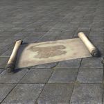 |
|
| Lead Location | The Lead can be bought from general goods merchants throughout Hew's Bane for 1,000 gold. Hew's Bane Pathfinder achievement required.—Amalien | |
| Codex Entries | I believe this is a map of Hew's Bane. It has a very distinctive shape. Does anyone else think it looks like a horse? | |
| Prince Hew set up the first sembalnces of a city near the harbor on the east side of the peninsula. It wasn't much at first, but over time it transformed into a sprawling commercial port, despite the harsh environment.—Reginus Buca | ||
| You make it sound so glorious, Reginus! The truth is that Price Hew was a irresponsible clod. This maps don't tell the full tale of his blundering.—Verita Numida | ||
Antique Map of Malabal Tor[edit]
| Antique Map of Malabal Tor (view item page) |
||
|---|---|---|
| The cartographer paid special attention to the coast and waterways of Malabal Tor when rendering this map. | 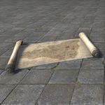 |
|
| Lead Location | The Lead can be bought from general goods merchants throughout Malabal Tor for 1,000 gold. Malabal Tor Pathfinder achievement required. | |
| Codex Entries | An old depiction of Malabal Tor, the Bosmeri heartland. See, here's Silvenar, and over here is Falinesti--the summer site, I believe. Of course, no one's seen it in a very long time. —Gabrielle Benele | |
| Interesting. Several Ayleid holds and cities are marked on the map: Abamath, Belarata, Ilayas. This map must have been made early in the First Era, shortly after the Ayleids withdrew to the Valenwood. Some of these sites were lost for centuries. —Reginus Buca | ||
| More likely the map was created by a cartographer working from older source material--mapmakers often incorporate the work of their predecessors into new maps, correcting and improving it. This parchment is old, but it's not three thousand years old. —Verita Numida | ||
Antique Map of Murkmire[edit]
| Antique Map of Murkmire (view item page) |
||
|---|---|---|
| The surveyor who succeeded in mapping the impenetrable marshlands of Murkmire made certain to note the migration of swamp leviathans. | 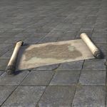 |
|
| Lead Location | The Lead can be bought from general goods merchants throughout Murkmire for 1,000 gold. Murkmire Pathfinder achievement required. | |
| Codex Entries | Difficult to say with certainty since its shores change so often, but I'm fairly confident this map depicts southern Black Marsh. Specifically the Murkmire region. —Verita Numida | |
| You're right, Verita. And you certainly weren't exaggerating when you spoke about the shores and terrain shifting. Just look where the cartographer placed Blackrose Prison and Lilmoth. —Ugron gro-Thumog | ||
| Black Marsh is virtually impossible to map effectively. Just ask any Imperial cartographer who's tried it. Very few make it back out of that gods-forsaken place alive, and those that do are always disappointed. —Reginus Buca | ||
Antique Map of Northern Elsweyr[edit]
| Antique Map of Northern Elsweyr (view item page) |
||
|---|---|---|
| The lands of Anequina and its majestic aqueduct are the subject of this skillfully illustrated map. | 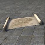 |
|
| Lead Location | The Lead can be bought from general goods merchants throughout Northern Elsweyr for 1,000 gold. Northern Elsweyr Pathfinder achievement required. | |
| Codex Entries | Ah! Hard to mistake this map, given the recent troubles in the region. It's Anequina sure enough. Northern Elsweyr, I mean. —Gabrielle Benele | |
| Hmm. It's clearly quite old, but the cartographer didn't include the boundaries of Elsweyr's sixteen kingdoms. I suppose the artist rendered it shortly after the northern half of the province consolidated under the Anequine banner. —Verita Numida | ||
| Yes, this clearly depicts the region just after the Thrassian Flu. It's quite odd to see a fully rendered map of the province. Travel in Elsweyr leans heavily upon word of mouth--mostly to keep Baandari caravaners employed. —Reginus Buca | ||
Antique Map of The Reach[edit]
| Antique Map of The Reach (view item page) |
||
|---|---|---|
| Reachfolk have little use for maps, knowing the land as well as they know their own bodies, so an intrepid explorer must have drafted this cartographic wonder—perfect for hanging on your wall or planning your next Reach excursion. | 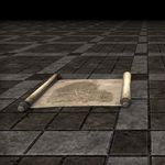 |
|
| Lead Location | The Lead can be bought from Innkeepers and General goods merchants in Markarth for 1,000 gold. The Reach Pathfinder achievement required. | |
| Codex Entries | I'm surprised by the thoroughness of this. Authentic maps of the Reach are hard to come by, especially before 1E 1000. I wonder who put this to paper, and how they went about acquiring that information. —Reginus Buca | |
| Safe to assume it wasn't the ancient Reachfolk themselves. This reeks of Imperial pretense. And since there are some pockets of land unlabeled, I'd guess they're the Reachclan strongholds that the Imperials never managed to penetrate. —Ugron gro-Thumog | ||
| It looks like both Red Eagle Redoubt and Markarth are accounted for, but rendered by a dismissive hand. I think Ugron is right. I'd place this map around Empress Hestra's reign, and definitely long after the disapperance [sic] of the Dwemer.—Amalien | ||
Antique Map of Reaper's March[edit]
| Antique Map of Reaper's March (view item page) |
||
|---|---|---|
| Skillful strokes create the boundaries and landmarks of Reaper's March on this map. | 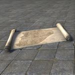 |
|
| Lead Location | The Lead can be bought from general goods merchants throughout Reaper's March for 1,000 gold. Reaper's March Pathfinder achievement required. | |
| Codex Entries | A map of the March. This land I know well. Bosmer, Khajiit, Colovians, and Imperials have fought over this place for centuries uncounted. The battles I could tell you of! —Ugron gro-Thumog | |
| The region's history of conflict no doubt shaped the warrior cultures of the nomadic Khajiit tribes. The rest of Tamriel knows the Khajiit as traveling merchants, but Anequina--the northern Khajiit realm--has always been a martial kingdom. —Verita Numida | ||
| Despite the name, the Reaper's March is more than just a battlefield. It's a melting pot of cultures. Yes, the Khajiit fought bloody wars here, but they also traded with other peoples and prospered in peaceful times. —Reginus Buca | ||
Antique Map of The Rift[edit]
| Antique Map of The Rift (view item page) |
||
|---|---|---|
| Despite its name, the sweeping temperate zone called the Rift is a hospitable place for Nords to come together, and this map points the way. | 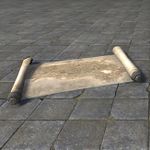 |
|
| Lead Location | The Lead can be bought from general goods merchants throughout The Rift for 1,000 gold. The Rift Pathfinder achievement required. | |
| Codex Entries | Oh, this seems to be a map of the Rift! It's hard to miss Lake Honrich and the Treva River. A much more temperate climate than the rest of Skyrim, really. —Gabrielle Benele | |
| And Giant territory, too! I wonder if any Giant burial grounds are marked on this map? I've heard that Giants seek out their ancestral burial grounds when they feel death drawing near. —Amalien | ||
| Giant burial grounds are less interesting than you might think. They take few belongings to the grave, and their kin do not tend the place where they are laid. You'll find little more than large bones and scraps of mammoth leather. —Ugron gro-Thumog | ||
Antique Map of Rivenspire[edit]
| Antique Map of Rivenspire (view item page) |
||
|---|---|---|
| Somehow the cartographer behind this map accurately rendered Rivenspire in great detail through all its gloom and fog. | 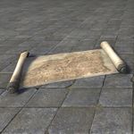 |
|
| Lead Location | The Lead can be bought from general goods merchants throughout Rivenspire for 1,000 gold. Rivenspire Pathfinder achievement required. | |
| Codex Entries | An annotated draft of the political map of the kingdom of Rivenspire once belonging to the royal cartographer of Shornhelm. The lines have been redrawn numerous times in varying colors of ink. It seems the nobility was quite divided on the matter. —Reginus Buca | |
| If they were anything like their descendants, then I'd say that's an understatement. The three major houses are constantly vying for control. It's a miracle that the kingdom isn't in a constant state of civil war, especially without a king on the throne. —Gabrielle Benele | ||
| The stewardship of these assorted baronies and counties was at the pleasure of the king. Holdings of the nobility would have shifted constantly as individuals gained or fell out of favor. These drafts may be as close to final as was possible. —Reginus Buca | ||
Antique Map of Shadowfen[edit]
| Antique Map of Shadowfen (view item page) |
||
|---|---|---|
| On this aged map, someone took great pains to depict the common paths and hazardous areas of the mire called Shadowfen. | 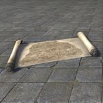 |
|
| Lead Location | The Lead can be bought from general goods merchants throughout Shadowfen for 1,000 gold. Shadowfen Pathfinder achievement required. | |
| Codex Entries | This is a treat! An Ayleid map of the Shadowfen region from very early in the First Era. The rendering of Stormhold looks almost aspirational. Several marks on here imply they had planned several locations for settlment. —Amalien | |
| These marks don 't necessarily imply settlement locations. I suggest they could be warnings. The Argonian population would not take kindly to encroachment in this era. They were much more isolated then. —Ugron gro-Thumog | ||
| You may be right. There are stories of an enormous battle between local Argonians and the Barsaebic Ayleids for control of the land where they'd construct Silyanorn. A shame that they could not live together in peace. —Amalien | ||
Antique Map of Southern Elsweyr[edit]
| Antique Map of Southern Elsweyr (view item page) |
||
|---|---|---|
| The kingdom of Pellitine stretches out like a lazing senche on this artistically rendered map. | 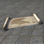 |
|
| Lead Location | The Lead can be bought from general goods merchants throughout Southern Elsweyr for 1,000 gold. Pellitine Pathfinder achievement required. | |
| Codex Entries | Ah, the wonders of Pellitine committed to history in genuine Elsweyr ink! Just glorious! —Reginus Buca | |
| Things certainly looked cleaner when this cartographer set paint to parchment. Look at these brush strokes. I doubt even Archmagister Vanus Galerion could match this Khajiit's artistry with the brush and pen. —Gabrielle Benele | ||
| I couldn't agree more. The world could use a return to classical penmanship and painting. Alas, I doubt we'll find much high culture in Southern Elsweyr nowadays. —Verita Numida | ||
Antique Map of Stonefalls[edit]
| Antique Map of Stonefalls (view item page) |
||
|---|---|---|
| Though the ashfall may obscure the features of Stonefalls, the clear lines of this map are an able guide. | 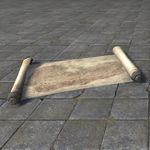 |
|
| Lead Location | The Lead can be bought from general goods merchants throughout Stonefalls for 1,000 gold. Stonefalls Pathfinder achievement required. | |
| Codex Entries | Stonefall's early history is replete with tales of struggle and invasion. The borders shifted a lot during the Merethic and First Eras. This map displays a fleetiong moment in time when ancient borders resembled those of the present day. —Amalien | |
| Indeed. Only a cartographer in service to the First Empire of the Nords would draft such a map. I'd date this to around the year 400 in the First Era. —Ugron gro-Thumog | ||
| If that's true, then pity the poor cartographer who needed to redraw this map only a few years later. Morrowind pushed hard to expel the Nords. Empires based on brutality rarely last long. —Verita Numida | ||
Antique Map of Stormhaven[edit]
| Antique Map of Stormhaven (view item page) |
||
|---|---|---|
| Even early maps of Stormhaven like this one show population centers, making the map a window into the past. | 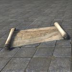 |
|
| Lead Location | The Lead can be bought from general goods merchants throughout Stormhaven for 1,000 gold. Stormhaven Pathfinder achievement required. | |
| Codex Entries | This is an Orcish map. Hard to believe it's real. Hardly anything from the time of first Orsinium survived the war that broke it. This map outlines the territory claimed around the Bjoulsae River. There's a settlement marked: Golkarr. —Ugron gro-Thumog | |
| Wasn't that the name of the Orc king from the thirty-year siege? I'd read that he invaded Stormhaven and blockaded Wayrest's trade lanes. There wasn't any mention of an Orc settlement. Was Golkarr an early casualty of the war? —Gabrielle Benele | ||
| It may never have been built. I doubt a treacherous ruler like Jolie would have tolerated Orcs for neighbors even if Golkarr was established peacefully. The justification for the razing of Orsinium was likely just the first of Jolie's many betrayals. —Ugron gro-Thumog | ||
Antique Map of Summerset[edit]
| Antique Map of Summerset (view item page) |
||
|---|---|---|
| While one wouldn't want to use this map for navigation, given its age, it makes for excellent wall art. | 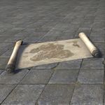 |
|
| Lead Location | The Lead can be bought from general goods merchants throughout Summerset for 1,000 gold. Summerset Pathfinder achievement required. | |
| Codex Entries | I'd recognize this map anywhere. Home. Summerset Isle. This map is old, but it's not too old. I've seen maps drafted by the Aldmer, and honestly, the landmarks are barely recognizable. —Amalien | |
| Amalien has the right of it. This map seems more utilitarian than strictly decorative. Something belonging to a ship's captain or a trader perhaps. —Ugron gro-Thumog | ||
| Odd that it doesn't include Auridon or Artaeum. I guess the cartographer wanted to express Summerset's primacy in the region. —Gabrielle Benele | ||
Antique Map of the Telvanni Peninsula[edit]
| Antique Map of the Telvanni Peninsula (view item page) |
||
|---|---|---|
| The fine detail work on the coastlines contrasts strongly with inland portions of the map. Almost as if House Telvanni had little interest in a truly accurate depiction of the peninsula. |  |
|
| Lead Location | The Lead can be bought from general goods merchants throughout the Telvanni Peninsula or Apocrypha for 1,000 gold. Hero of Necrom achievement required. | |
| Codex Entries | This is curious. Definitely First Era, maybe soon after Veloth led the Chimer here. Note that the coastlines are very well-defined, but when we get into the interior regions the mapping becomes much more sketchy. —Amalien | |
| And the ink. That looks like squid ink. And the parchment itself has a faint aroma of salt. I'd say that this is a nautical chart, and an ancient one at that. The name Necrom isn't used here, but there was definitely a settlement already flourishing. —Ugron gro-Thumog | ||
| Agreed. I would go so far to say that this is Akaviri in origin. It could be a set of battle plans from an early invasion, but I think it was an early portolan chart, used for early, peaceful trade between the continents. —Verita Numida | ||
Antique Map of Vvardenfell[edit]
| Antique Map of Vvardenfell (view item page) |
||
|---|---|---|
| The vastness of Red Mountain is truly apparent in this scale map of Vvardenfell. | 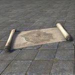 |
|
| Lead Location | The Lead can be bought from general goods merchants throughout Vvardenfell for 1,000 gold. Morrowind Pathfinder achievement required. | |
| Codex Entries | Vvardenfell's unique, volcanic geography make Vvardenfell one of the most difficult places in Tamriel to map. The island's silhouette, however, is unmistakable. —Reginus Buca | |
| Ha! Tribunal priests are the true impediments to cartography in the region. I can scarcely believe how often the island is locked away, reopened, and so on. Travel to the island is quite simple nowadays, but you'll find many doors closed to outsiders. —Verita Numida | ||
| As you well know, few maps are original works. I'd wager this is a composite of several different maps -- perhaps even Dwemer ones! —Amalien | ||
Antique Map of Wrothgar[edit]
| Antique Map of Wrothgar (view item page) |
||
|---|---|---|
| The treacherous mountains of Wrothgar are expertly depicted on this map, though safe passage through them is anyone's guess. | 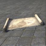 |
|
| Lead Location | The Lead can be bought from general goods merchants throughout Wrothgar for 1,000 gold. Wrothgar Pathfinder achievement required. | |
| Codex Entries | An aged depiction of Wrothgar if my eyes aren't mistaken. —Reginus Buca | |
| I don's see any references to the original thirteen strongholds. Of course, Imperial cartographers never spent much time digging into the details of Orcish stronghold-law. —Ugron gro-Thumog | ||
| Not Imperial, Ugron. I detect a Breton influence on this. It seems overwrought to me--almost florid. A High Rock artist likely designed this as a commemoration of the first sack of Orsinium. —Verita Numida | ||